mountains

International Day of Forests

Hungary-woodland-forest-winter-foggy (2).jpg

Each year on March 21st, the International day of Forests celebrates and raises awareness of the importance of all types of forests. With this short selection, I would like to draw attention to the importance of forests.

2012 óta minden év március 21-én az erdők nemzetközi napját ünnepeljük. Ezzel a rövid válogatással szeretném felhívni a figyelmet az erdők fontosságára.

Hungary-woodland-forest-winter-foggy (4).jpg
Hungary-woodland-forest-winter-foggy (5).jpg
Hungary-woodland-forest-winter-foggy (1).jpg
Hungary-woodland-forest-winter-foggy (3).jpg
Hungary-woodland-forest-winter-foggy (6).jpg
Hungary-woodland-forest-winter-foggy (8).jpg
Hungary-woodland-forest-winter-foggy (9).jpg
Hungary-woodland-forest-winter-foggy (7).jpg


South Africa, the Panorama route part I.

One of the highlights of a trip to South Africa is, without a doubt, the Panorama Route. It  features numerous waterfalls, one of the largest afforested areas in South Africa, and several natural landmarks. Our first stop was the God’s window.

According to the internet, God’s Window is a famous natural landmark found along the Panorama Route in Mpumalanga and offers a magnificent viewpoint over the greenest canyon in the world. The cliffs drop away to an astonishing 700 - 900m gorge filled with trees, shrubs, and wildlife. On a clear day, you'll be able to see across the famous Kruger National Park. Forming part of a 250km long series of cliffs, God's Window is absolutely captivating in its beauty.

Unfortunately we had no luck, after we arrived we saw this scenery. The God’s window was literally closed.

Dél-Afrikai utazás egyik fénypontja kétségkívül a panoráma út, amely mentén számos vízesés, Dél-Afrika egyik legnagyobb erdősített területe és számos természeti nevezetesség található. Az első megállónk a God’s window volt. Az interneten található leírások alapján az Isten ablaka a 250 km hosszú sziklasorozat részeként csodálatos kilátást nyújt a világ legzöldebb kanyonjára, a 700-900 méter magas szurdokról tiszta időben ellátni egészen a Krüger Nemzeti Parkig.

Sajnos nem volt szerencsénk, a buszból kiszállva ez a látvány fogadott, Isten ablaka szó szerint zárva volt.

South-Africa-Panorama-route-Gods-window (1)-3.jpg

I was so devasteted like everyone else in the group, although I could not capture this tree without this atmosphere. This is one of my favorite from this trip.

Csalódott voltam, mint mindenki más a csoportból, nem is maradtunk tovább tíz percnél. Ennek ellenére elmentünk a kilátó pontig, ahol végül is sikerült megörökítenem az egyik kedvenc képemet erről az utazásról.

South-Africa-Panorama-route-Gods-window (2)-2.jpg

We were lucky with the weather for the rest of the day. We continued our journey to the Lisbon Falls, which is the tallest waterfall in South Africa at an altitude of 94 meters.

A nap további részében szerencsénk volt az idővel. Tovább folytattuk az utunkat és a következő megálló a Lisszabon vízesés volt, mely 94 méteres magasságával Dél-Afrika legmagasabb vízesése.

South-Africa-Panorama-route-Lisbon-falls (4).jpg
South-Africa-Panorama-route-Lisbon-falls (2).jpg

Our next stop was the Berlin falls, which flow down for 80 m into a deep dark green hole surrounded by red cliffs.

Ezután következett a Berlin vízesés, mely 80 méteres magasságával, vöröses szikláival és különleges növényzetével elvarázsolt.

South-Africa-Panorama-route-Berlin-falls (1).jpg
South-Africa-Panorama-route-Berlin-falls (3)2.jpg
South-Africa-Panorama-route-Berlin-falls (2).jpg
South-Africa-Panorama-route-Berlin-falls (4).jpg

Popular lookout point

Hungary-Dobogoko-lookout-point-mountains-11.jpg

Dobogókő perhaps is the most popular hiking destination lately. Great panorama, easy access, not far from Budapest. Because of its popularity, it is really hard to make new, fresh and unique pictures, but on days when there are such conditions, it might be a little easier.

Dobogókőt talán nem kell senkinek bemutatni, az idei tél egyik legfelkapottabb kiránduló helye. Nem csoda, hiszen könnyen megközelíthető, viszonylag közel van Budapesthez és páratlan panorámával varázsol el minket.

Hungary-Dobogoko-lookout-point-mountains-16.jpg
Hungary-Dobogoko-lookout-point-mountains-12.jpg
Hungary-Dobogoko-lookout-point-mountains-17.jpg
Hungary-Dobogoko-lookout-point-mountains-15.jpg
Hungary-Dobogoko-lookout-point-mountains-19.jpg


One of my favorite forest

hungary-erd-duna-part-woodland-2.jpg

I usually use Google maps to scout new locations to visit, that’s how I found this little floodplain forest right on the bank of the Danube. It is not a huge, enchanted forest, but still captivated by its atmosphere and variety. I have visited several times in the last few months.

Általában a Google maps segítségével keresek új helyszíneket, így találtam rá erre a kicsi ártéri erdőre is, nem messze Budapesttől Érden a Duna partján. Nem egy hatalmas, elvarázsolt erdő, mégis magával ragadott a hangulata, így többször is jártam itt az elmúlt pár hónapban.

hungary-erd-duna-part-woodland-8.jpg
hungary-erd-duna-part-woodland-9.jpg

Although the leaves have already fallen, it is so beautiful and colorful even so.

Habár az ősz elmúlt már, szürkeségnek nyoma sincs.

hungary-erd-duna-part-woodland-5.jpg
hungary-erd-duna-part-woodland-4.jpg
hungary-erd-duna-part-woodland-10.jpg
hungary-erd-duna-part-woodland-11.jpg


A mystical place, Selyem-réti tanösvény

hungary-selyemreti-tanosveny-ocsa-woodland-5.jpg

This place in itself is quite mystical, but if we are lucky and manage to visit it in a foggy dawn, it will show its true face. The swampy, marshy part itself is not very long, but the view can be enjoyed for long minutes.

Ez a hely önmagában is elég misztikus, de ha szerencsénk van és sikerül egy ködös hajnalban meglátogatni, megmutatja az igazi arcát. Maga a mocsaras, lápos rész nem túl hosszú, azonban a látványban hosszú perceken át lehet gyönyörködni.

hungary-selyemreti-tanosveny-ocsa-woodland-3.jpg
hungary-selyemreti-tanosveny-ocsa-woodland-8.jpg

Although it is not recommended to deviate from the trail without proper clothing, nature allows you to explore a few meters.

Ugyan nem ajánlott megfelelő öltözet nélkül letérni az ösvényről, de egy pár méter barangolást enged a természet.

hungary-selyemreti-tanosveny-ocsa-woodland-2.jpg
hungary-selyemreti-tanosveny-ocsa-woodland-7.jpg

It is worth continuing our journey even after the marshy part.

Érdemes a lápos rész után is folytatni  utunkat.

hungary-selyemreti-tanosveny-ocsa-woodland.jpg

termeszetjaro-selyem-reti-tanosveny.png

This map shows the route of the trip.

A mellékelt térképen látható a túra útvonala.


Discover Tarnai resting-place

Not far from Telki, in the direction of Budakeszi, there is a beautiful resting place. There is no forest on the hillside, open grassland with dolomite cliffs on the surface, so you can enjoy the fantastic views in all directions of the Buda Mountains.

Telkitől nem messze, Budakeszi irányában található egy gyönyörű pihenő hely, a Tarnai pihenő. A Csergezán Pál kilátóhoz vezető úton juthatunk el oda. Ha csak egy rövidebb sétára van időnk, nem kell a kilátóig mennünk a páratlan kilátáshoz. A hegyoldalon erdőt nem találunk, nyílt gyepes terület, a felszínén dolomit sziklagyeppel, így fantasztikus kilátást élvezhetünk minden irányban a Budakeszi-medencére és a Budai-hegység néhány gerincére.


paty-tarnai-piheno-terkep.jpg

This map shows the route of the trip.

A mellékelt térképen látható a túra útvonala.


Lovely pine forest near Páty

This is one of my favorite places near Budapest, right next to Páty. Leaving the main road, you can reach this wonderful pine forest through a small forest path. It is good to go early in the morning because it is very cozy and quiet and the scenery is beautiful, it is worth getting up early.

Ez az egyik kedvenc helyem Budapest közelében, mely közvetlenül Páty mellett található. A főútról letérve egy kis erdei ösvényen keresztül lehet megközelíteni ezt a csodálatos fenyvest. Érdemes kora reggel menni, mert nagyon hangulatos és csendes, gyönyörű a látvány, megéri korán kelni.

I was there for the first time in the fall, I was fascinated by the colorful scenery.

Első alkalommal az ősz beköszöntével jártam itt, mely átmenetileg gyönyörű színpompába borította a tájat.

Even after the autumn, it is worth exploring the area. If you are lucky enough, you can see wild animals as well.

Az ősz elmúltával is érdemes bebarangolni a környéket, ha szerencsénk van még vadállatokkal is találkozhatunk.


paty-terkep.jpg

This map shows the route of the trip.

A mellékelt térképen látható a túra útvonala.


Sunset on the top of Nagy-Szénás

Nagy-Szénás is located near Nagykovácsi, by car you can get there from Budapest in just over half an hour. After an easy half hour walk, on the top of the moutain you can enjoy the spectacular views of the Pilis and Buda Hills.

Nagy-Szénás, Nagykovácsi határában található, bő fél óra alatt közelíthető meg Budapestről autóval. A hegytető egy kellemes fél órás sétával elérhető, ahonnan a Pilis és a Budai-hegység számos csúcsának a látványa fogad minket.

Nagy-Szénás is one of the few mountain peaks where no forest can be found. The peak is barren, covered with grass and stones and due to its dullness the weather is usually windy. Thanks to this, we get a 360-degree panorama, which I think is one of the best views in the immediate vicinity of Budapest.

Nagy-Szénás azon kevés hegytetők egyike, ahol nem találunk erdőt. A csúcsa kopár, fűvel és kövekkel borított. A kopársága miatt általában szeles az idő. Ennek köszönhetően 360 fokos panoráma fogad minket, véleményem szerint ez az egyik legjobb kilátás Budapest közvetlen közelében.

If you are planning a short afternoon hike, it is definitely unbeatable.

Ha csak egy rövid délutáni túrát tervezünk, akkor mindenképpen verhetetlen, mert egészen elképesztő látványban lesz részünk.


terkep-nagy-szenas.jpg

This map shows the route of the trip.

A mellékelt térképen látható a túra útvonala.


Almost sunrise in Szekrényes-hegy

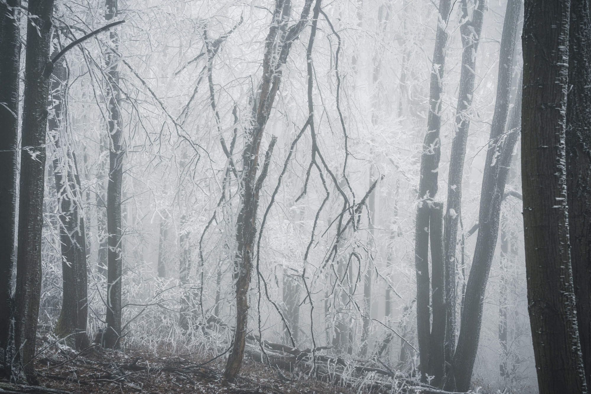
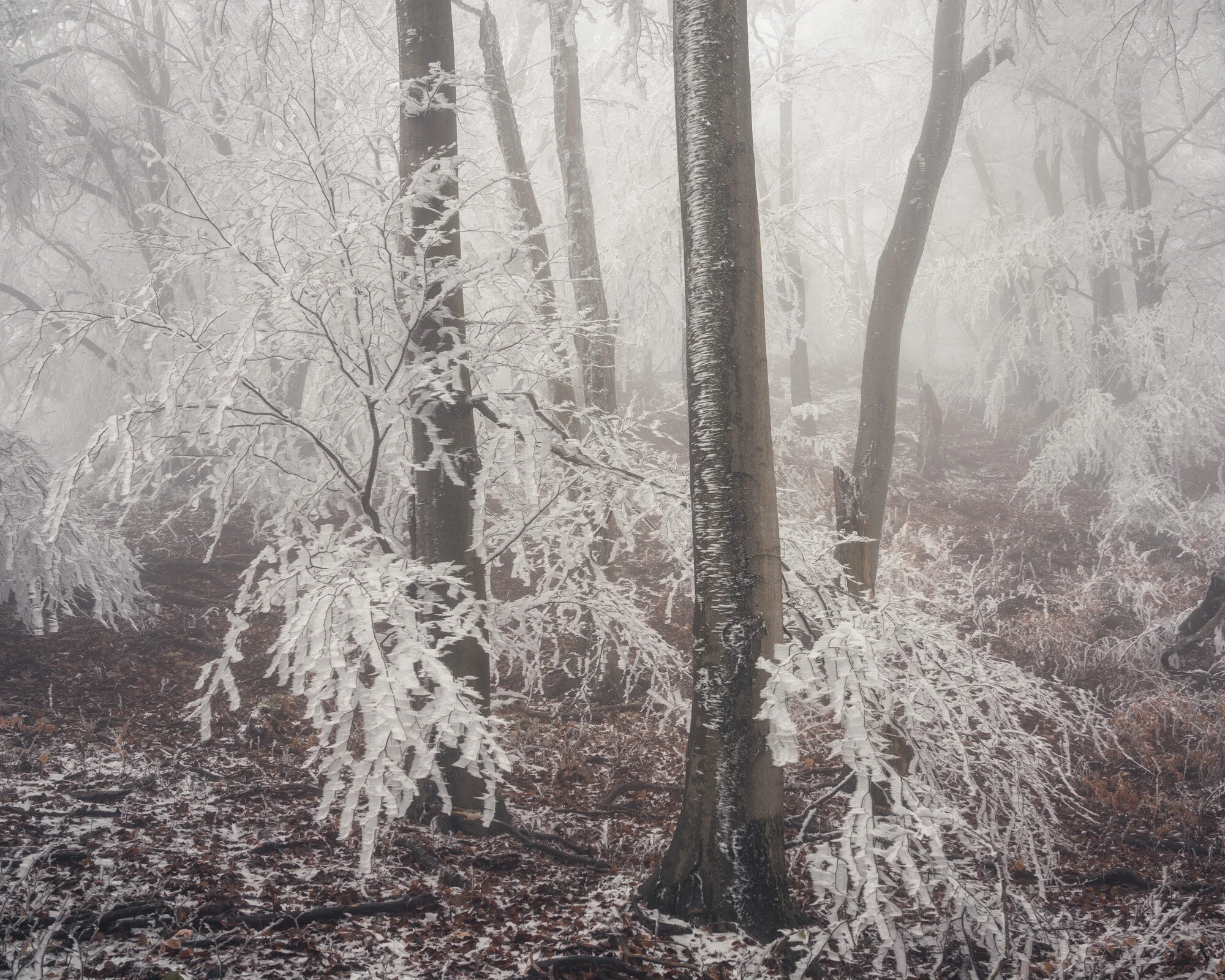
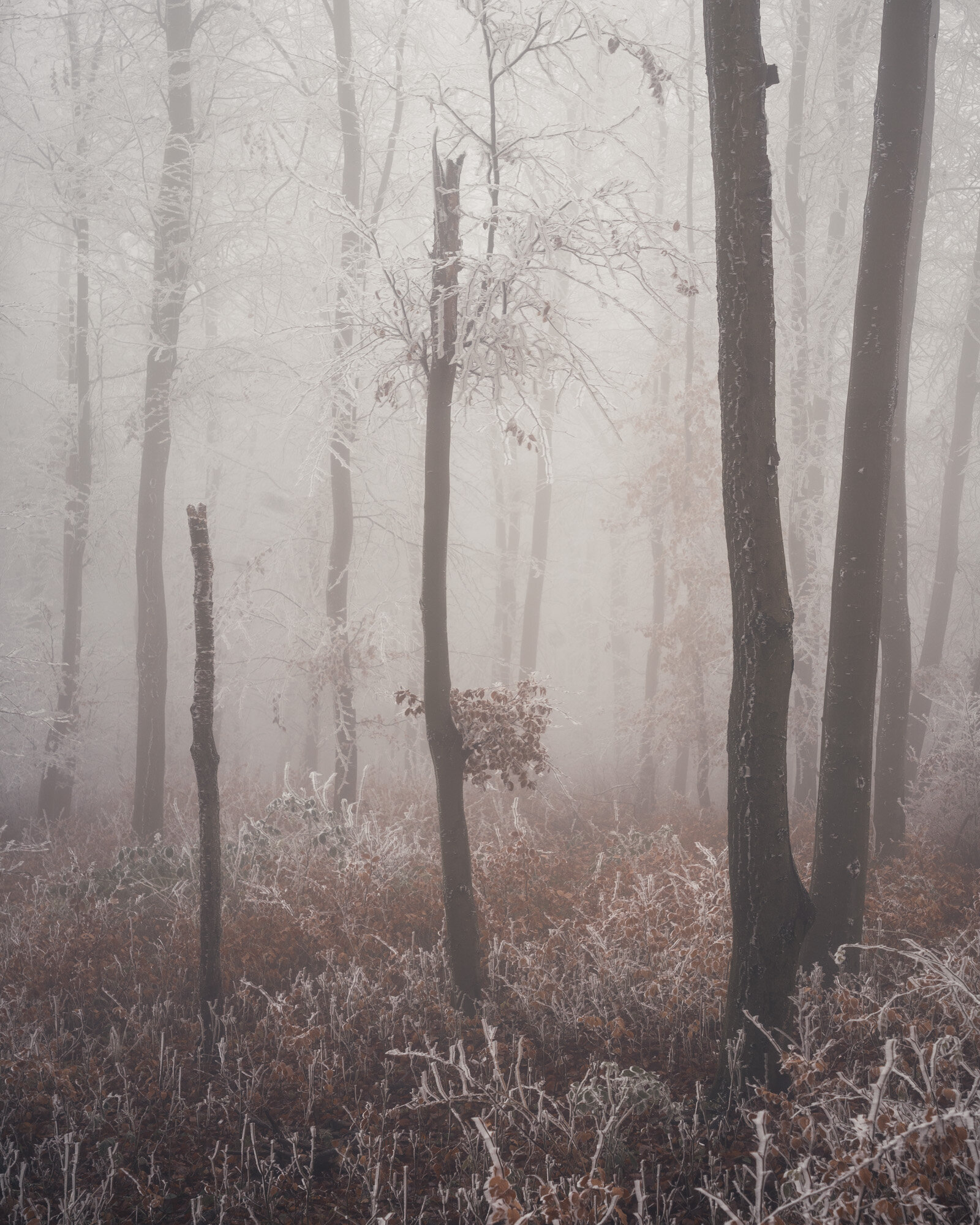
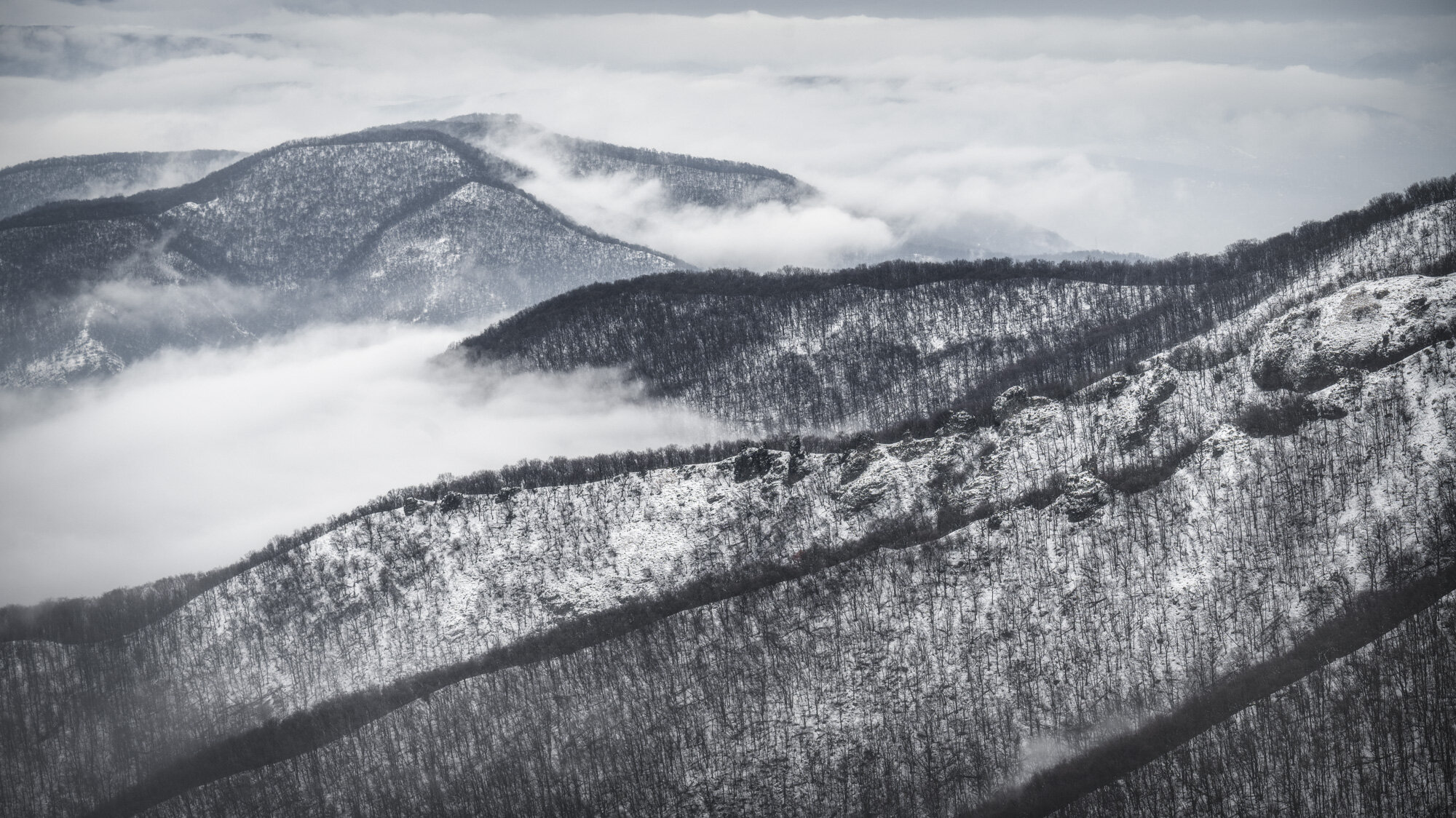
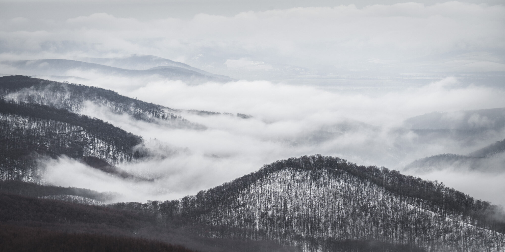
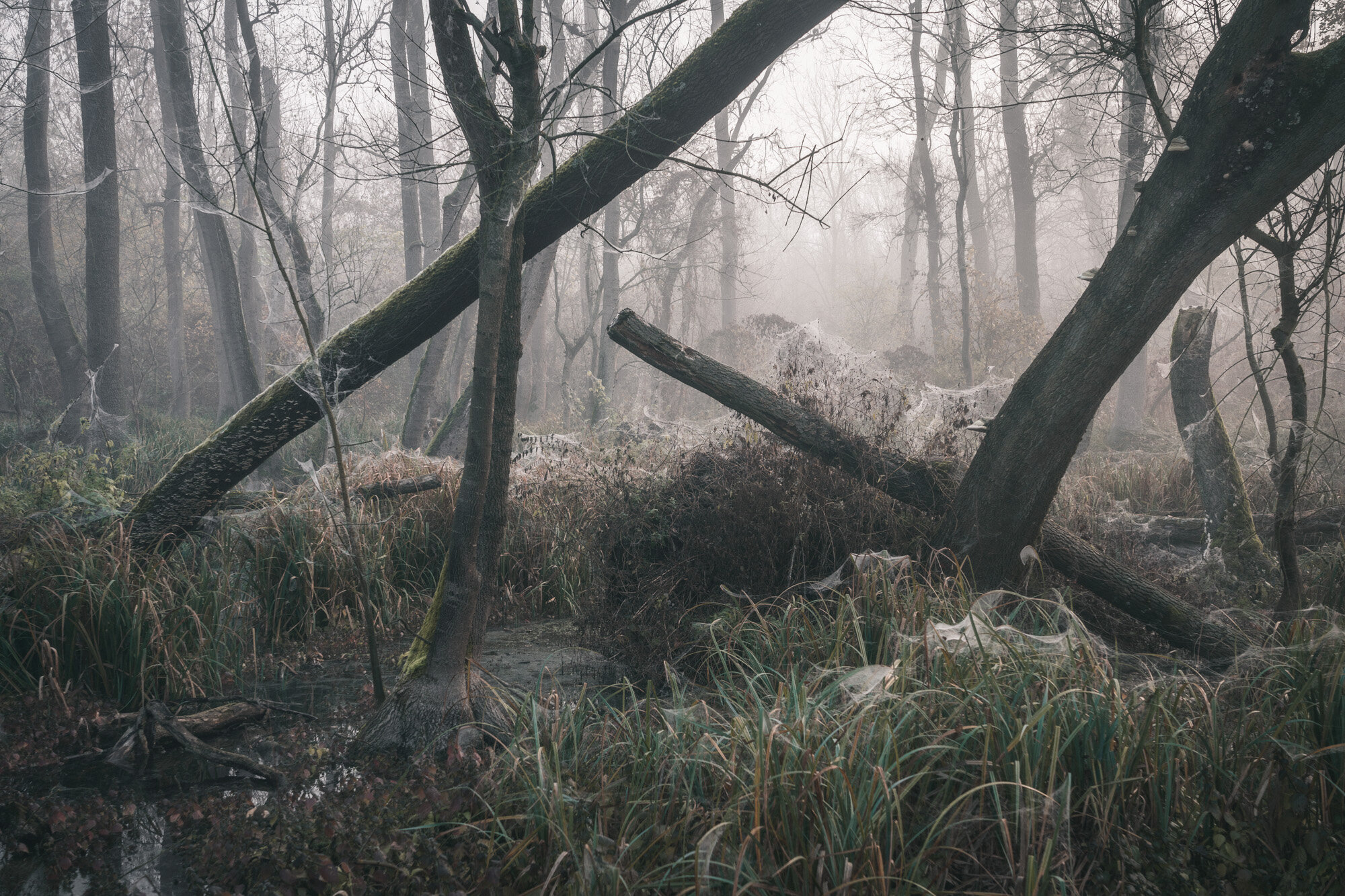
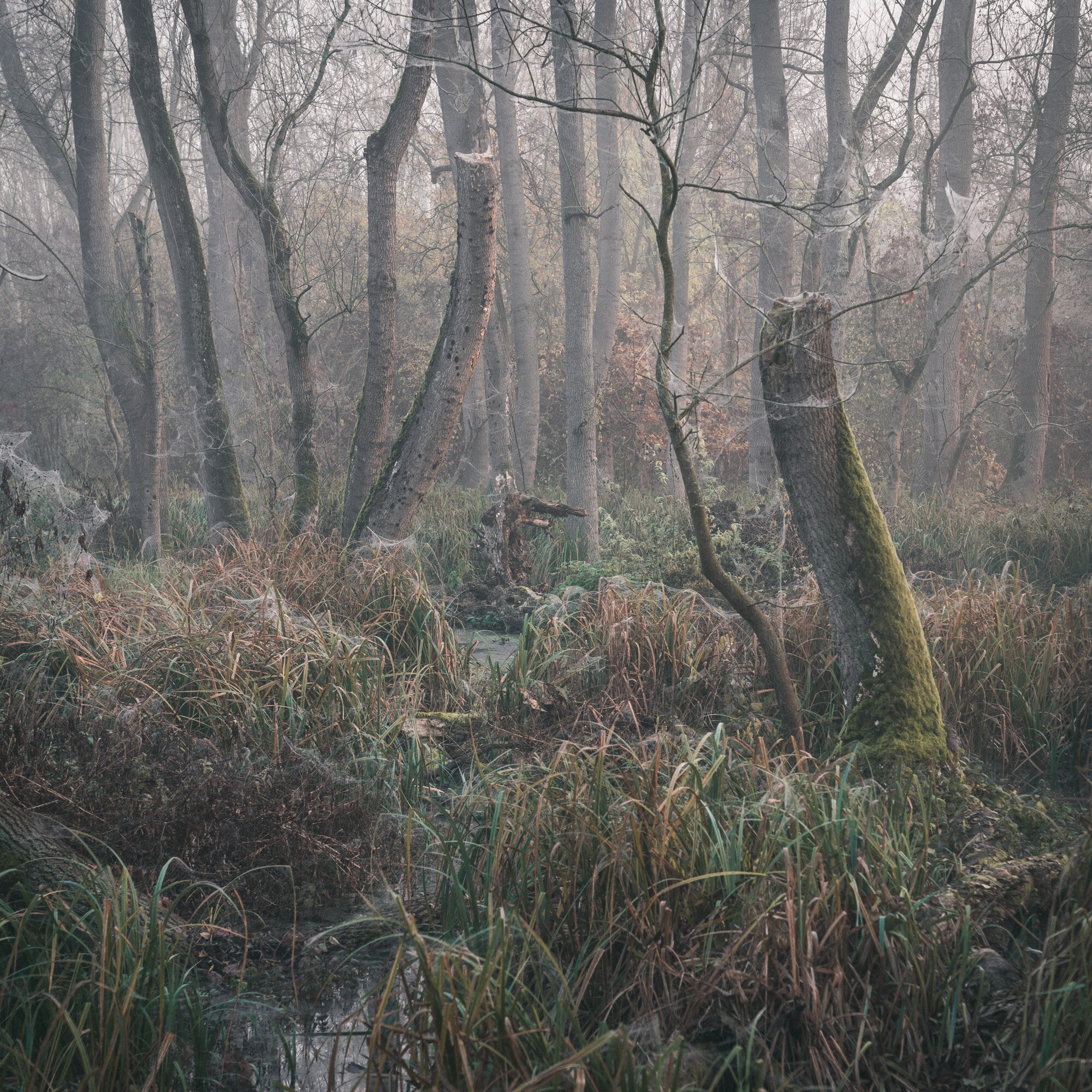
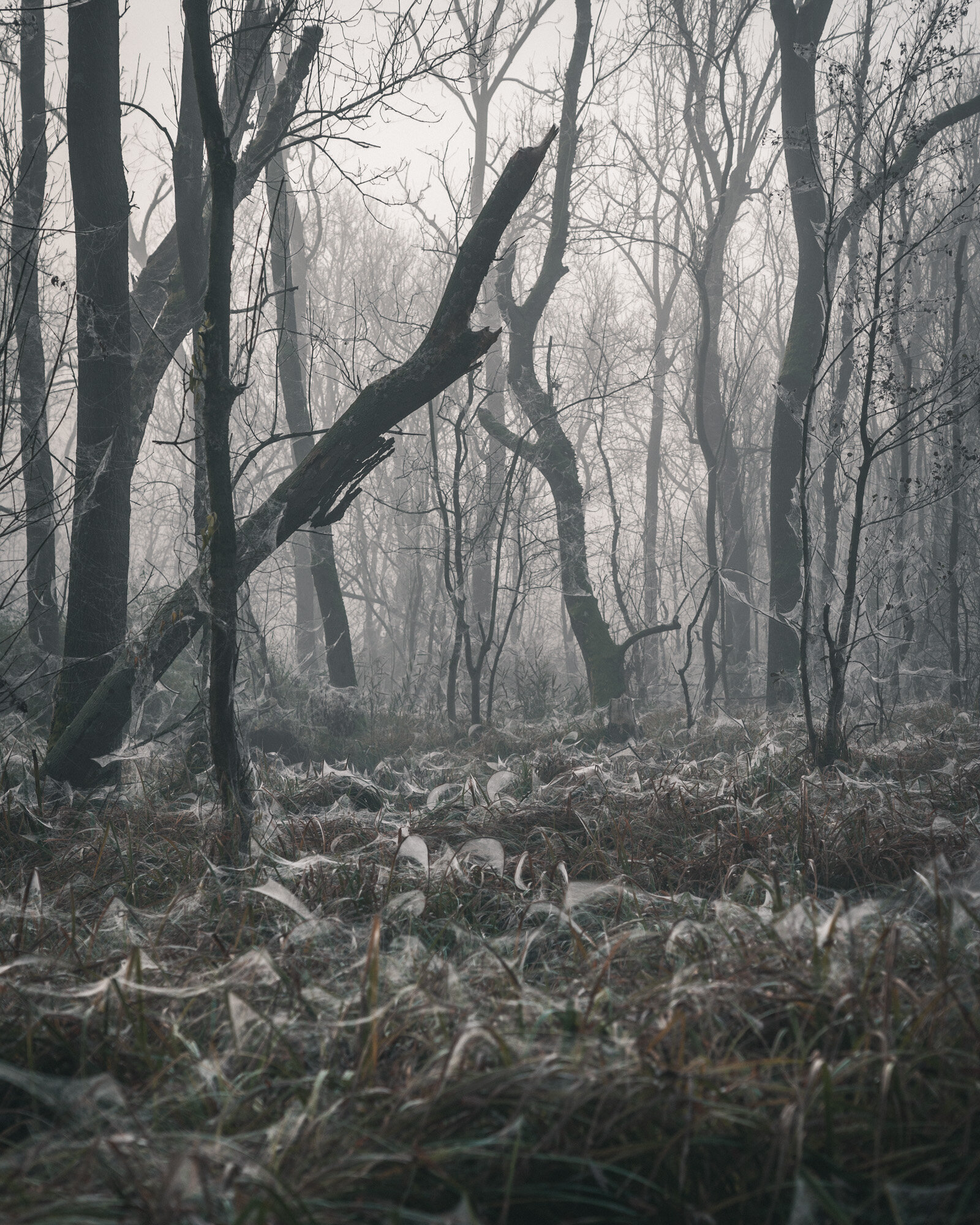
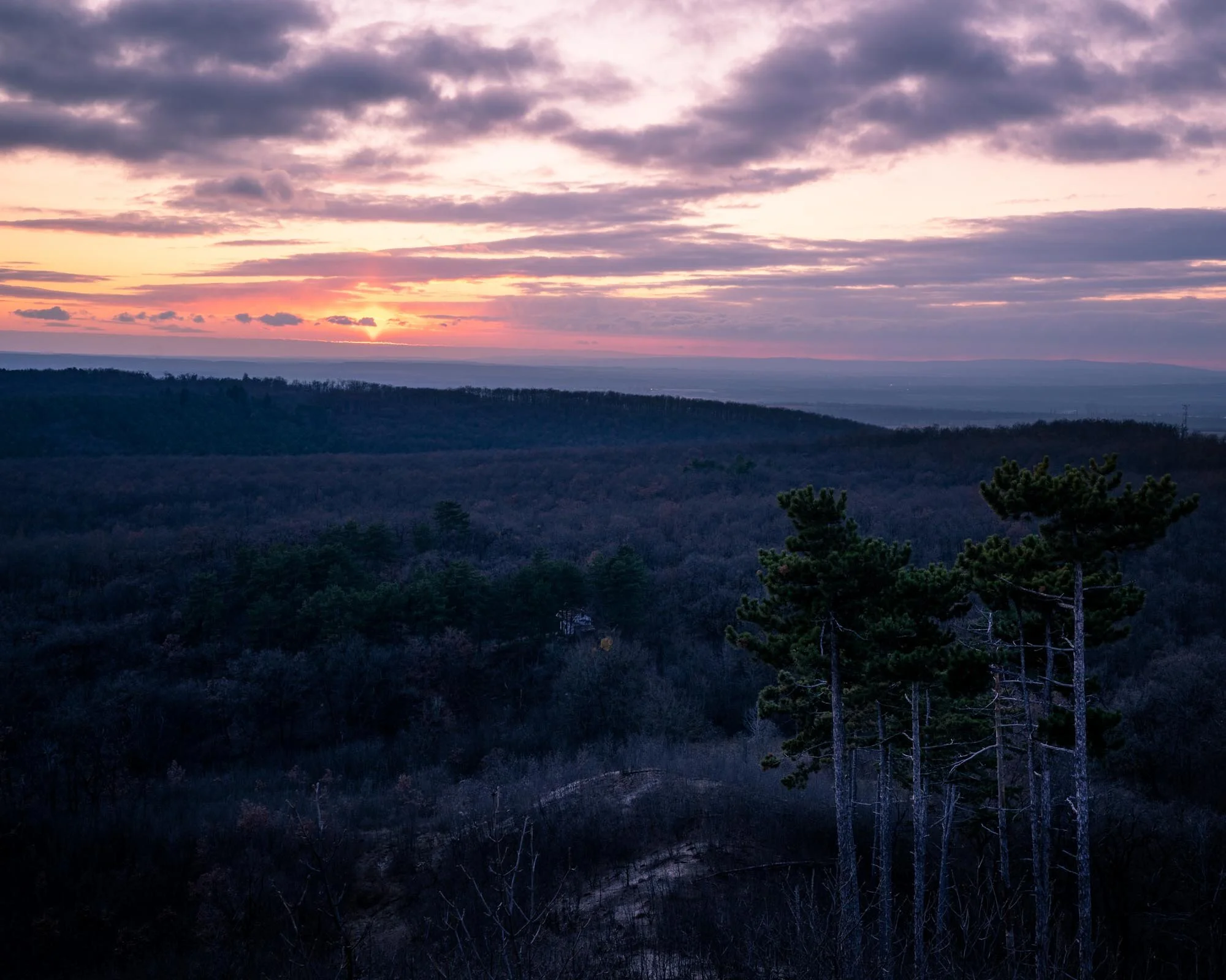
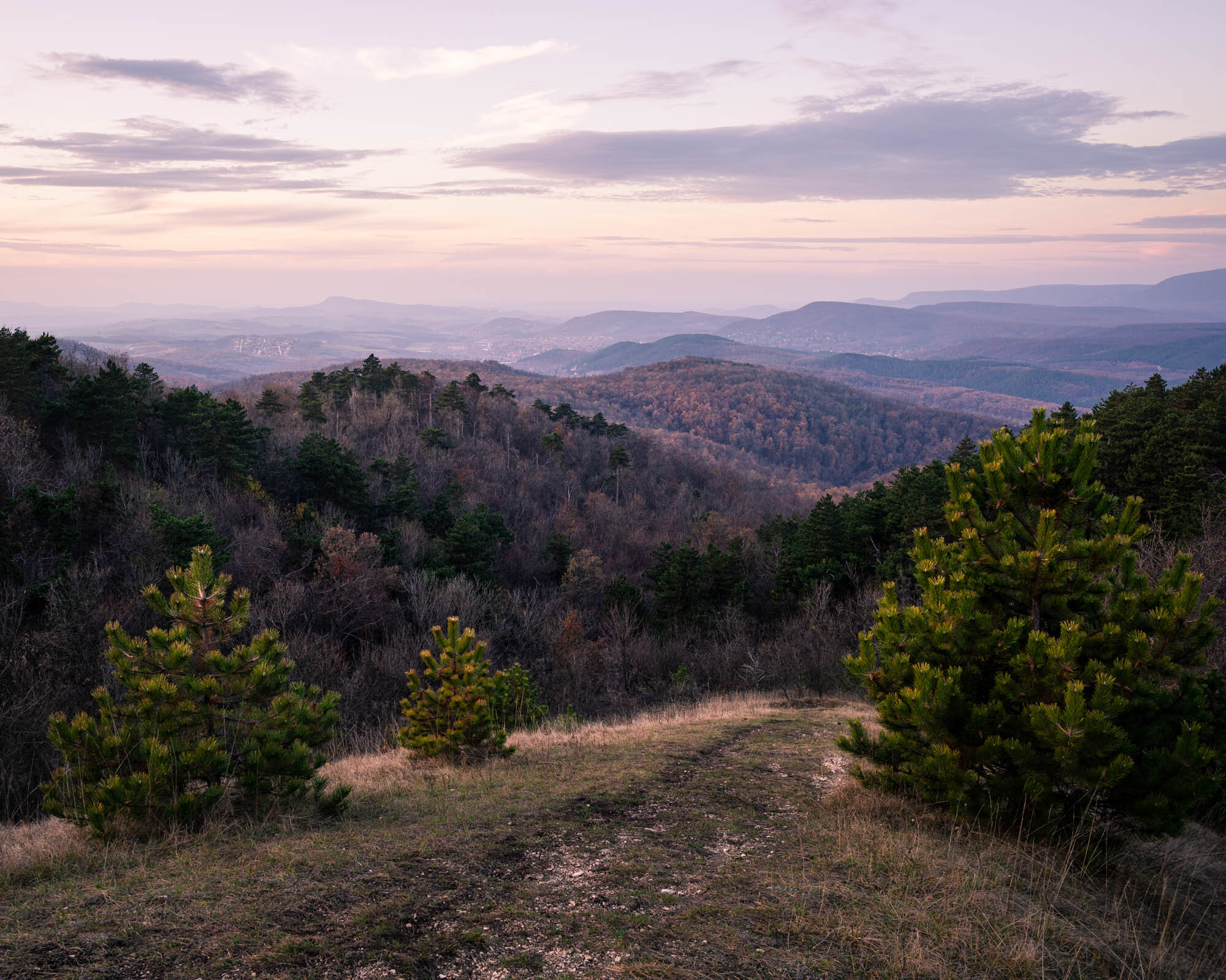
I have to admit, it was hard to get up so early to capture the sunrise in Szekrényes mountain. Moreover, it was doubtful whether the sun would come out of the clouds or not, but I was hoping that I would be lucky. After finding the right place, I set up the camera and the tripod and waited for the miracle. However, increasingly gloomy clouds were gathering around me, and fog began to obscure the landscape. It was so amazing so I decided to make the shot. After that I came to the conclusion that the fog and the forest were good friends, so there was no question of leaving the top of the mountain for the forest. A few weeks ago, I found a nice little path, surrounded by beautiful trees. Then I decided that if the fog descends, I would get it again. An hour later I got to the scene near the Sorrento cliffs and the Sinka Lajos memorial plaque. The trees, the littla path, the fog and the mysterious lights were quite amazing. I managed to capture the moment the way I wanted it to, as I planned it a few weeks ago. It was worth getting up because it was a marvelous trip without sunrise.

Be kell vallanom, nehezemre esett felkelni korán, hogy napfelkeltére már fent legyek a Szekrényes-hegyen. Ráadásul kétséges volt, hogy egyáltalán előbújik-e a felhők mögül a nap, hiszen tudtam, hogy felhős időt jósoltak. De reménykedtem benne, hogy hátha szerencsém lesz. Mivel jártam itt már korábban, volt elképzelésem honnan kapjam lencsevégre a várva várt napfelkeltét. Miután megtaláltam a helyet, előkészítettem a gépet az állvánnyal és vártam a csodára. Azonban egyre komorabb felhők gyülekeztek körülöttem, és köd kezdte ellepni a tájat. Így hát a napot ködre cserélve elkészítettem a képet, majd pakolni kezdtem. Viszont egy rövid gondolkodás után arra jutottam, hogy bizony a köd és az erdő jó barátok, így nem volt kérdés, hogy elhagyva a hegy tetejét az erdő fele vegyem az irányt. Pár héttel ezelőtt találtam egy szép kis ösvényt, akkor elhatároztam, hogy ha leszáll a köd újra lencsevégre kapom. Egy óra múlva oda is értem a helyszínre, mely a Sorrento sziklák és a Sinka Lajos emléktábla közelében van. A fák, a kis ösvény, a köd, a sejtelmes fények, egészen csodálatos látványt nyújtott. Sikerült úgy elkapnom a pillanatot, ahogy szerettem volna, ahogy megterveztem. Megérte felkelni és napfelkelte nélkül is egy csodálatos fotós túra volt.


This map shows the route of the trip. Why I like it? Because it is close to Budapest, it is relatively short (appr. 4.3 km), you can reach the Szekrényes mountain (point D) or Farkas mountain (point M) within twenty minutes through the forest, and if you have just a short time to go outside, you can have a beatiful view in the top of these mountains, without completing the whole trip. Woodland photos made in the middle of the hike, between H and I.

A mellékelt térképen látható a túra útvonala. Azért szeretem ezt a környéket, mert közel van Budapesthez, viszonylag rövid táv (4.3 km), és ha nincs idő az egész környéket bejárni, egy 20 perces erdei séta után elérhető a Szekrényes-hegy (D jelzés) és Farkas-hegy (M jelzés), ahol csodálatos kilátás fogad minket. Az erdei képek a H és I pont között készültek.

Screenshot_20191111_202402_com.outdooractive_edited.jpg